The Nifty Ninety Peak Challenge!

The years 2020-2022 were, and continue to be, challenging years for travelers (as well as most everyone else)! Concern about COVID-19 brought change throughout the world. In many places, people were required to stay home, at least periodically, except for essential needs. Compounding the difficulty was that many countries closed their borders to visitors. Fortunately for us we had the Nifty Ninety to keep us occupied. We did a presentation on it for the 2023 ALDHA RUCK in Feb and the handout is at susandalcorn.com/mountain-peaks/links-for-bay-area-nifty-ninety-and-ridge-trail/
Searching for Plan B
The restrictions on travel may have caused people to cancel travel plans, but if they live in the San Francisco Bay Area, or visit, there are hundreds of hiking trails they can enjoy. ln December 2017, the Sierra Club, Bay Chapter, ran an article in their magazine describing the Nifty Ninety Peaks challenge. The goal was to reach the summit of the 90 named peaks or high points in the greater S.F. Bay Area. Print the list from peakbagger.com/List.aspx?lid=5059 or use the Sierra Club Nifty Ninety pdf: sierraclub.org/sites/www.sierraclub.org/files/sce-authors/u1054/Nifty%2090.pdf
If you would like the list as a spreadsheet, you can download this slightly reformatted version from Google Sheets: tinyurl.com/NiftyNinetySpreadsheet
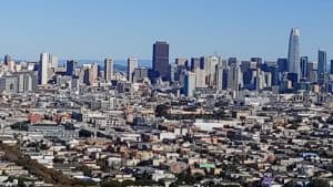
The peaks on the list are intriguing: Nob Hill, Telegraph Hill, and Russian Hill, all in San Francisco, are attractive, well-known tourist spots. Mount Diablo, Mount Tamalpais, and Mission Peak are landmarks—high points in the region that can be seen from a great distance. The hikes represent a wide range of difficulty, and there is a mix of city walks and wilderness treks.
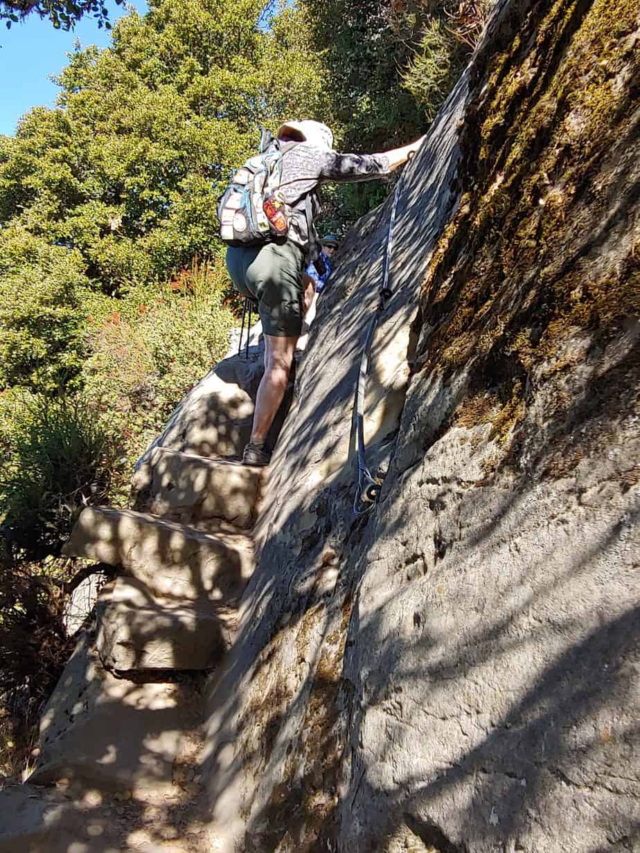
All of the trails are on public property and are “walk-up” summits rather than climbs—though a couple have a short scramble at the finish. They can be reached by nearly anyone in good physical condition, with proper gear and preparation. As always, know your personal limits and read descriptions and reports before setting out.
Though travel afar may be out of reach at the moment, climbing all or some of the Nifty Ninety will provide many benefits to your health and well being.
Be sure to check your destination before you set out because some trails remain closed due to either COVID-19 or fire damage or risk.
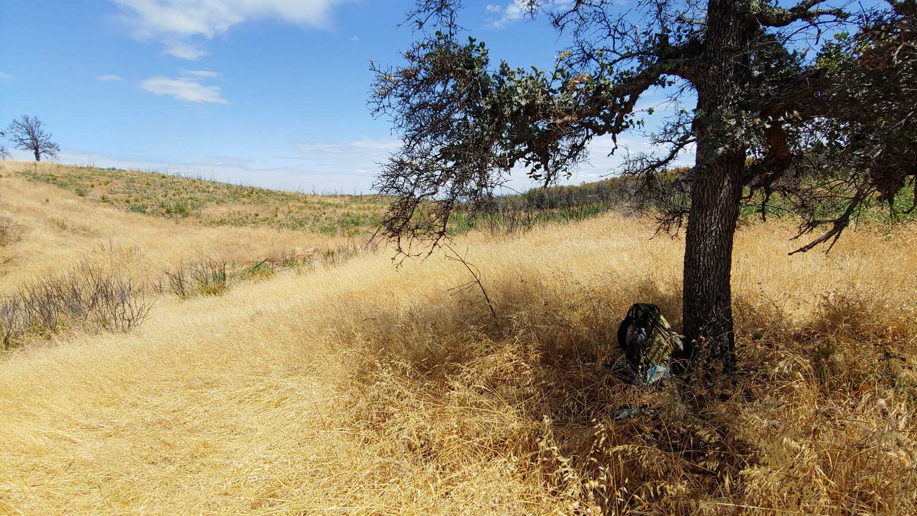
We try to hike regularly
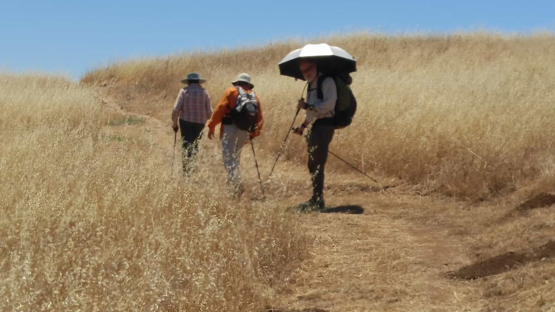
At first my husband Ralph and I did some peaks in nearby regional parks. Even though we had been in these parks before, the challenge led us to new trails to reach the peaks.
We soon were captivated. The novelty of new trails spurred us on. Views from hills or mountaintops offered better long-distance views than canyons and flatlands. Our determination to do all 90 of the peaks was reinforced when we found our friends Patricia Schaffarczyk and Tom Coroneos shared our new interest. Soon after, they became part of our regular “team.”
We have completed all 90 peaks. We would have done all much sooner if 2020-21 had not brought Covid-19 restrictions and wildfires, but we continued when time, weather, and other conditions favored.
In the process of doing the hikes, we used both the Sierra Club list and that at Peakbagger.com—both great resources. However, we found the amount of information provided varied from peak to peak.
The Sierra Club’s list groups the peaks under such headings as “State Parks” and “Peninsula Regional Parks,” which is a little tricky to follow unless you already know where the parks are. Much as I like the Peakbagger website, where we can read about other people’s attempts and record our own, the peaks are listed by elevation rather than location. Elevation is good to know, but it is only one part of a successful ascent. Travel distance and time, trail length, terrain, sometimes even accessibility to drinking water are also important to consider.
A variation = adding info and combining strengths of other lists
The following list gives the peaks in alphabetical form within the counties of the Bay Area. It gives elevations and nearest town or other key location. And finally, it gives my subjective rating of difficulty.
You can look through the listings to see what peaks are in which vicinities and plan accordingly.
The peaks listed in bold type are linked to articles I’ve published about some of the high points we have climbed. You can look through the listings to see what peaks are in which vicinities and plan accordingly.
Even with the lists available, most of our hikes have required a fair amount of planning—how to reach the trailheads, which trail to take to a peak, and if there are others in the vicinity. In addition to the Peakbagger site, we often use Alltrails.com.
The Nifty Ninety Peaks of the S.F. Bay Area
Again, check before you set out! Some trails or areas are still closed due to COVID-19 concerns or fire damage or wildfire risk.
Alameda County’s Nifty Ninety peaks:
Brushy Peak (1702’) — Brushy Peak Regional
Preserve, Livermore. Moderate
Donlan Point (1139’) — Dublin Hills Regional Park, Dublin. Moderate.
Eagle Peak, (1720’) — Las Trampas Regional Wilderness, Danville/Alamo. Difficult.
Flag Hill (1,360′) — Sunol Regional Park (with Vista Grande), Sunol. Moderate.
Garin Peak (948’) — Garin Regional Park, Hayward. Moderate.
Gossip Rock (1080’) — Dry Creek Pioneer Regional Park, Fremont. Moderate.
Grizzly Peak (1740’) — Tilden Regional Park, Berkeley. Easy.
Las Trampas Peak (1827’) — Las Trampas Regional Park, Danville. Moderate.
Maguire Peak (1702’) — Sunol Regional Park, Sunol, Moderate
Mission Peak (2517’) — Mission Peak Regional Preserve, Fremont. Moderate
Monument Pk. (2600’) — Mission Peak Regional Preserve, Fremont. Difficult.
Redwood Peak (1619’) — Redwood Regional Park, Oakland, Easy.
Rose Peak (3817’) — Ohlone Wilderness, Sunol. Difficult.
Round Top (1763’) — Sibley Regional Park, Oakland, Easy.
Schlieper Rock (3080’) — Ohlone Wilderness, Sunol. Difficult.
Tolman Peak (1080’) — Dry Creek Pioneer Regional Park, Moderate
Vail Peak (1789’) — Las Trampas Regional Wilderness, Alamo. Moderate.
Vista Grande (1840′) — Sunol Regional Pk., (with Flag Hill), Sunol. Moderate
Vollmer Peak (1905’) — Tilden Regional Park, Berkeley, Moderate.
Wildcat Peak (1211’) — Tilden Regional Park, Berkeley, Moderate.
Contra Costa County peaks:
 Briones Peak (1483′) — Briones Regional Park, 3 trailheads: Lafayette, Martinez, or Orinda. Moderate.
Eagle Peak (2,369′) — Mt. Diablo State Park, Clayton. Difficult.
Mott Pk. (1424’) — Briones Regional Park, 3 trailheads: Lafayette, Martinez, or Orinda. Moderate.
Mt. Diablo (3,849’) — Mt. Diablo State Park. North: Walnut Creek, South: Danville. You can drive to the summit of Mt. Diablo, but there are many trail options available. From Juniper campground, Moderate; from South Park entrance, Difficult. Info from Mount Diablo State Park site.
Mt. Olympia (2946’) — Mt. Diablo State Park, Contra Costa CTY
Mt. Wanda (640′) — John Muir Ntl. Histor. Site, Martinez. Moderate.
North Peak (3557’) — Mt. Diablo State Park. Difficult
Rose Hill (1506′) — Black Diamond Regional, Pittsburg. Moderate.
Russell Peak (1357’) — Briones Regional Park, Briones Regional Park, 3 trailheads: Lafayette, Martinez, or Orinda. Moderate.
Marin County’s Nifty Ninety:

Barnabe Peak (1466′) — Samuel P. Taylor SP, Lagunitas, Moderate/Difficult
Burdell Mtn.(1,558′) — Olompali SP. Access from San Marin Drive, Novato. Moderate. Access also from Olompali SP off Highway 101, Novato. Difficult.
Hawk Hill (920’) — Golden Gate Ntl. Rec. Area, Sausalito. Easy
Hill 88 (950′) — aka Wolf Ridge (below) Golden Gate Ntl. Rec./Marin Headlands. Sausalito. Moderate
Loma Alta (1,592)’— Loma Alta Open Space, Fairfax. Moderately Easy.
Pilot Knob (1185′) — Mt. Tamalpais watershed, Greenbrae. Moderate.
Mt. Tamalpais – East Peak (2572’) — Mount Tamalpais State Park. Mill Valley and more. You can drive nearly to the summit for an Easy hike, or start at Stinson Beach for Difficult—and many variations in between.
Mt. Wittenberg (1407’) — Pt. Reyes Ntl. Seashore, Pt. Reyes Station. Many options — ranging Easy to Difficult.
Pine Mountain (1762) — Mt. Tamalpais watershed, Fairfax. Credited as being the birthplace of mountain biking. After a rain, consider combining hike to Carson Falls. Moderate.
Point Reyes Hill (1342’) — Pt. Reyes Ntl. Seashore, Point Reyes Station. Moderate.
San Pedro Mountain (1080’) — San Pedro Mtn. Open Space, San Rafael, Easy to Moderate depending on route.
Slacker Hill (937’) — Golden Gate Ntl. Recreation Area, Sausalito (with Hawk Hill). Easy.
White Hill, 1,439′ — White Hill Open Space, Marin CTY
Wolf Ridge (aka Hill 88 given above (960’) — Golden Gate Ntl. Rec. Area, Sausalito. Moderate.
Napa County:
Berryessa Peak (3057’) — Berryessa Snow Mtn. SP, Pope Valley. Difficult.
Coyote Peak (1170’) Bothe-Napa Valley State Park, St. Helena. Easy.
Mt. Saint Helena (4343’) — Robert Lewis Stevenson State Pk., Calistoga. Difficult (to do with Mt. Saint Helena-South)
Mt. Saint Helena – South (4003’) — Robert Lewis Stevenson State Pk. Calistoga. Difficult (to do with Mt. Saint Helena)
Mt. Vaca ((2819’) — Vacaville. Easy to Moderate depending on starting point.
Sugarloaf (1630’) — Skyline Wilderness Park. Napa. Moderate.
San Francisco, City and County:
Bernal Heights (459′) — San Francisco. Easy.
Corona Heights Crag (500’) — San Francisco. Easy.
Hayes Hill (270’) — San Francisco. Easy.
Nob Hill (325′) — San Francisco (with Telegraph Hill and Russian Hill). Easy.
Mt. Davidson (925’) — San Francisco. Easy.
Mt. Livermore (788′) — Angel Island SP (aka Caroline Livermore) S.F. Bay. Moderate.
Russian Hill (300′) — San Francisco (with Nob Hill and Telegraph Hill). Easy.
Mt. Sutro (908’) — San Francisco. Easy-Moderate.
Tank Hill (600’) — San Francisco. Easy.
Telegraph Hill (275′) — San Francisco (with Nob Hill and Russian Hill). Easy.
Twin Peaks (922’) — San Francisco. Easy.
San Mateo County Nifty Ninety:
Black Mountain (2,812′) — Monte Bello Open Space Preserve, Los Altos. (completed along with Windy Hill). Moderate.
Borel Hill (2572’) — Russian Ridge Open Space Preserve, La Honda. Moderate.
Mindego Hill (2143’) — Russian Ridge Open Space Preserve, La Honda. Moderate.
Montara Mountain, North Peak (1,898′) — San Pedro Valley County Park, Pacifica/Montara. Drive Linda Mar Rd. up the hill to reach the park’s entrance unless you want a more difficult hike from the beach in Pacifica. Moderate.
San Bruno Mtn. (1,314′) — San Bruno Mt. SP, Brisbane. Easy loop available. levels.
Windy Hill, 1905′ — Windy Hills Open Space Preserve, Easy out and back available. (same trip as Black Mountain)
Santa Clara County:
Antler Point (2,999′) — Joseph D. Grant County Park, Santa Clara CTY. Moderate.
Bald Mtn. (2387’) — Sierra Azul Open Space, Los Gatos. Moderate.
Bills Hill (1988’) — Henry Coe State Park, Gilroy. Difficult.
Burra Burra (2281’) — Henry Coe State Park, Gilroy. Easy from Dowdy Ranch Entrance.
Church Hill (1,450′) — Almaden Quicksilver CTY Park, Santa Clara CTY. (with Mines Hill). Moderate.
Coyote Peak (1155’) — Santa Teresa County Park, Santa Jose. Easy.
El Sombroso (3000’) — Sierra Azul Open Space Preserve, Los Gatos, Moderate to DIfficult.
Goat Rock (2920’) — Castle Rock State Park, Saratoga. Excellent example of Tafoni Rock. Moderate.
Mines Hill (1,728′) — Almaden Quicksilver County. Park, San Jose. (along with Church Hill. Moderate.
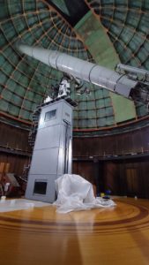
Mt. Hamilton (4343’) — Joseph D. Grant County Park, San Jose. Home of Lick Observatory. Possible to drive to the top or to hike from a lower elevation. Easy to Moderate depending on access.
Mt. Madonna (1897’) — Mt. Madonna County Park, Gilroy or Watsonville. Possible to drive to top. Easy to Moderate depending on trailhead.
Mt. Sizer (3216’) — Henry Coe State Park, Santa Clara & Stanislaus CTY. Difficult.
Mt. Umunhum (3486’) — Sierra Azul Open Space Preserve, Los Gatos. Possible to drive to the top or hike from a lower elevation. Combine with Bald Mtn. Moderate.
Nibbs Knob (aka Knibbs) (2694’) — Uvas Canyon County Park, Morgan Hill. Moderate/Difficult.
Saint Joseph’s Hill (1253’) — St. Joseph’s Open Space Preserve, Los Gatos. Easy.
Table Mountain (1852’) — Upper Stevens Creek County Park, Los Gatos. Moderate.
Vasquez Peak (2210’) — Henry Coe State Park, Santa Clara & Stanislaus CTY. Moderate/Difficult.
Willson Peak (2651’) — Henry Coe State Park, Santa Clara & Stanislaus CTY. Moderate.
Santa Cruz County:
Chalk Mountain, 1,609′ — Big Basin Redwoods SP, Saratoga. Moderate. If combined with the Sea to Summit hike, strenuous.
Mount McAbee (1730′) — Big Basin Redwoods SP, Saratoga/Boulder Creek. Moderate.
Pine Mtn. (2,208′) — Big Basin Redwoods SP, Saratoga. Moderate. Scramble at the end.
Solano County just one Nifty Ninety peak:
Sulfur Springs Mtn. (1112’) — Hiddenbrooke Open Space, Vallejo. Moderate.
Sonoma County:
Bald Mtn. (2729’) — Sugarloaf Ridge State Park, Kenwood. Moderately-Strenuous.
Borel Hill (2572’) — Russian Ridge Open Space Preserve, Palo Alto. Easy
Mt. Hood (2730’) — Mt. Hood Regional Preserve, Santa Rosa. Strenuous.
Table Rock (2462’) — Robert Lewis Stevenson SP., Calistoga. Moderate.
Related Nifty Ninety blog posts from Backpack45’s Musings:
Bad weather? What to do: When the weather or other circumstances mean we can’t hike.
Susan’s Nifty Ninety Peaks article in All Women, All Trails.
LAST UPDATED 7/30/22